Wingtra
The professional VTOL drone for mapping and surveying
Overview
|
HQ Location
Switzerland
|
Year Founded
2015
|
Company Type
Private
|
Revenue
< $10m
|
|
Employees
51 - 200
|
Website
|
Company Description
Wingtra is a professional drone manufacturer based in Zurich, Switzerland. The company produces the VTOL WingtraOne drone, which collects high-precision aerial data for surveying and mapping applications. Since its market entry in 2017, Wingtra has partnered with more than 50 of the biggest surveying equipment dealers across the globe, such as RDO Inc. and SITECH.
IoT Solutions
Our drone WingtraOne carries the best in class sensors that collect survey-grade aerial data. This technologically superior VTOL drone is used by mapping professionals in application that range from surveying and mining to wildlife monitoring. The recently launched WingtraOne PPK drone can offer all in one: broad coverage, brilliant resolution and accuracy down to 1 cm (0.4 in).

IoT Snapshot
Wingtra is a provider of Industrial IoT drones technologies, and also active in the agriculture, construction and infrastructure, and mining industries.
Technology Stack
Wingtra’s Technology Stack maps Wingtra’s participation in the drones IoT Technology stack.
-
Devices Layer
-
Edge Layer
-
Cloud Layer
-
Application Layer
-
Supporting Technologies
Technological Capability:
None
Minor
Moderate
Strong

Supplier missing?
Start adding your own!
Register with your work email and create a new supplier profile for your business.
Case Studies.
Case Study
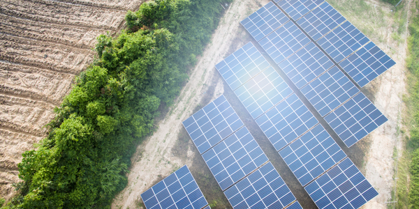
Drone Solar Panel Inspection: A Case Study on PCL Construction
PCL Construction, one of the largest construction companies in Canada and the United States, faced a significant challenge when it came to drone data capture for solar construction projects. The company's existing quadcopters and multirotors were not sufficient for the task due to the repetitive and demanding nature of solar field construction projects. These projects required reliable data for daily monitoring, which the existing drones could not provide. The construction of solar fields happens in 'waves,' with production teams driving more than a thousand piles a day and module crews placing five times as many solar panels in the same timeframe. This fast-paced, large-scale construction offered a limited view from the ground, making drone data crucial. However, the company needed a dependable workflow and a processing engine that could deliver orthomosaics to the superintendent every night.
Similar Suppliers.
Supplier
Draganfly
Draganfly Innovations Inc. is the world leader in sUAS systems. We create machines that make a difference in the world. From flying outings in the park with our hobby line products to protecting emergency service personnel in dangerous situations via our high end, industrial platforms, we are constantly working towards delivering the best possible machines for our customers.


Supplier
Boonray
Boonray is a leader in the field of commercial UAV and data intelligence in China and is committed to the development of UAV applications. Unlike other drone manufacturers, their technology focuses on the intelligent building of UAV operations built for mining UAV data. Also, laser technology with advanced software and hardware technology allows for data acquisition intelligence and a cloud data intelligent analysis function module, UAV operating systems, and facilitating customers large-scale deployment. The system helps customers more easily collect air information, analyze and share it to enhance the efficiency of the management. Boonray technology have been serving customers in government, PV inspection and geographical mapping.